PRESS RELEASE
THE EC-SAFEMOBIL PROJECT REACHES THE EXPECTED GOALS AT THE END OF THE PROJECT
This project is led by the Centre for Advanced Aerospace Technologies (FADA-CATEC) and the University of Seville. EC-SAFEMOBIL, coordinated by Prof. Ollero, seeks to develop autonomous systems and unmanned aerial vehicles that can play an important role in many applications, including disaster management and the monitoring and measurement of events.
The expected industrial results were focused on 5 scenarios:
SCENARIO 1 Rotary-wing UAV landing on mobile platform,
SCENARIO 2 Rotary-wing landing on a moving platform using a tether,
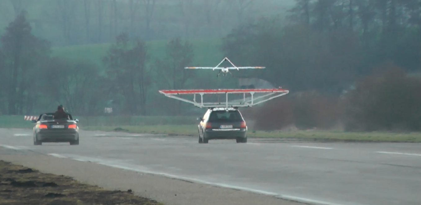
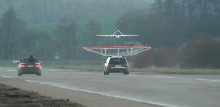
SCENARIO 3 Landing of a fixed-wing UAV on top of a moving ground vehicle,
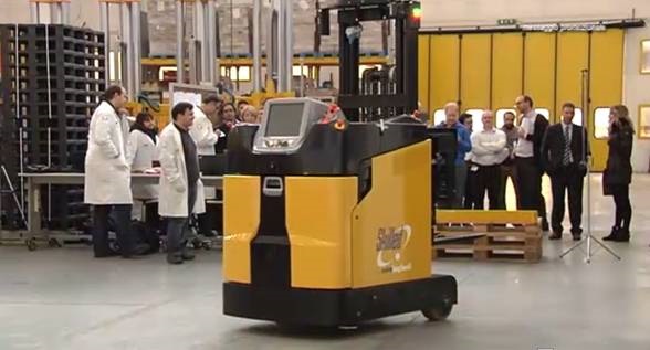
SCENARIO 4 Autonomous distributed warehousing,
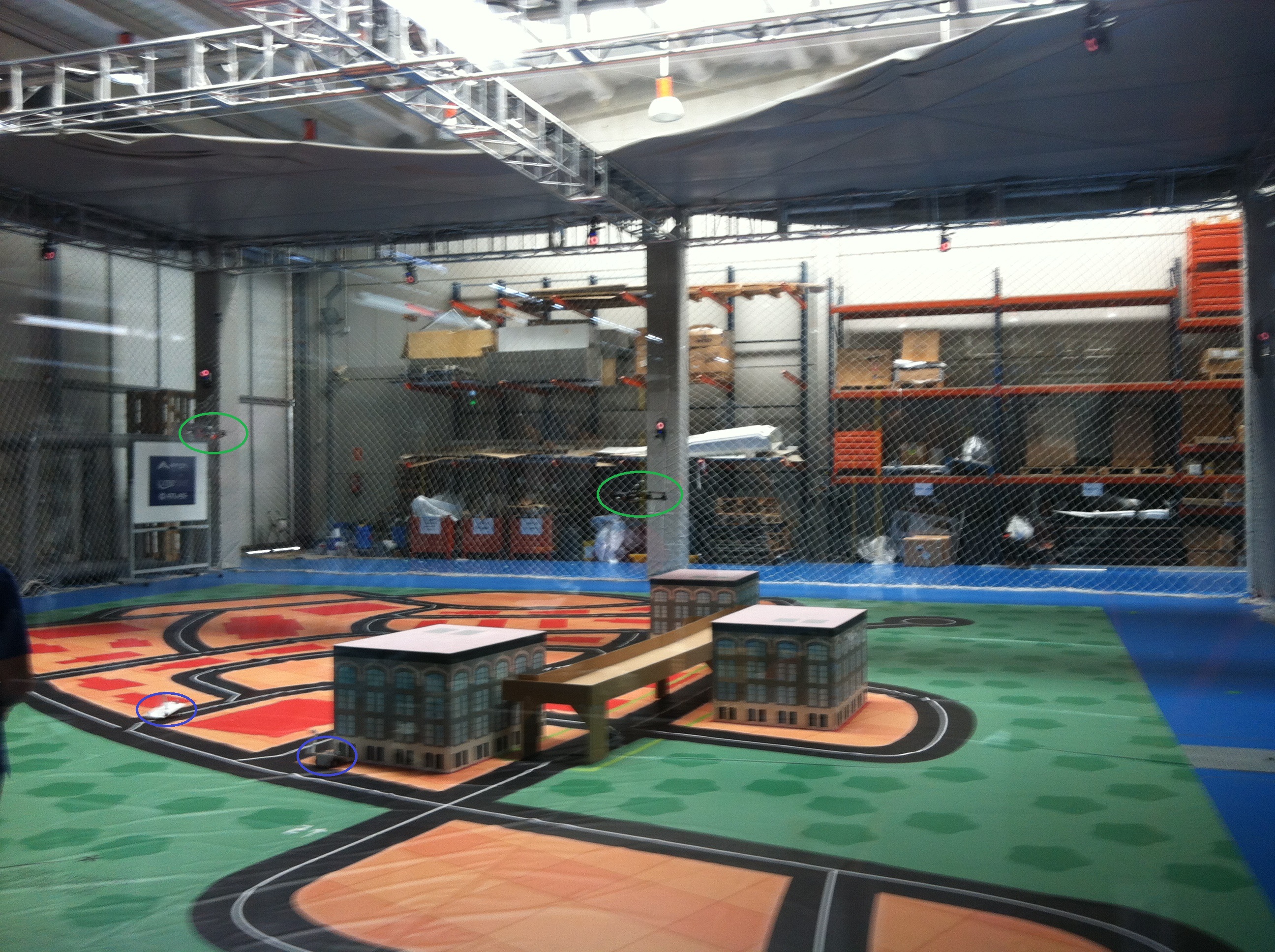
SCENARIO 5 Tracking and Surveillance.
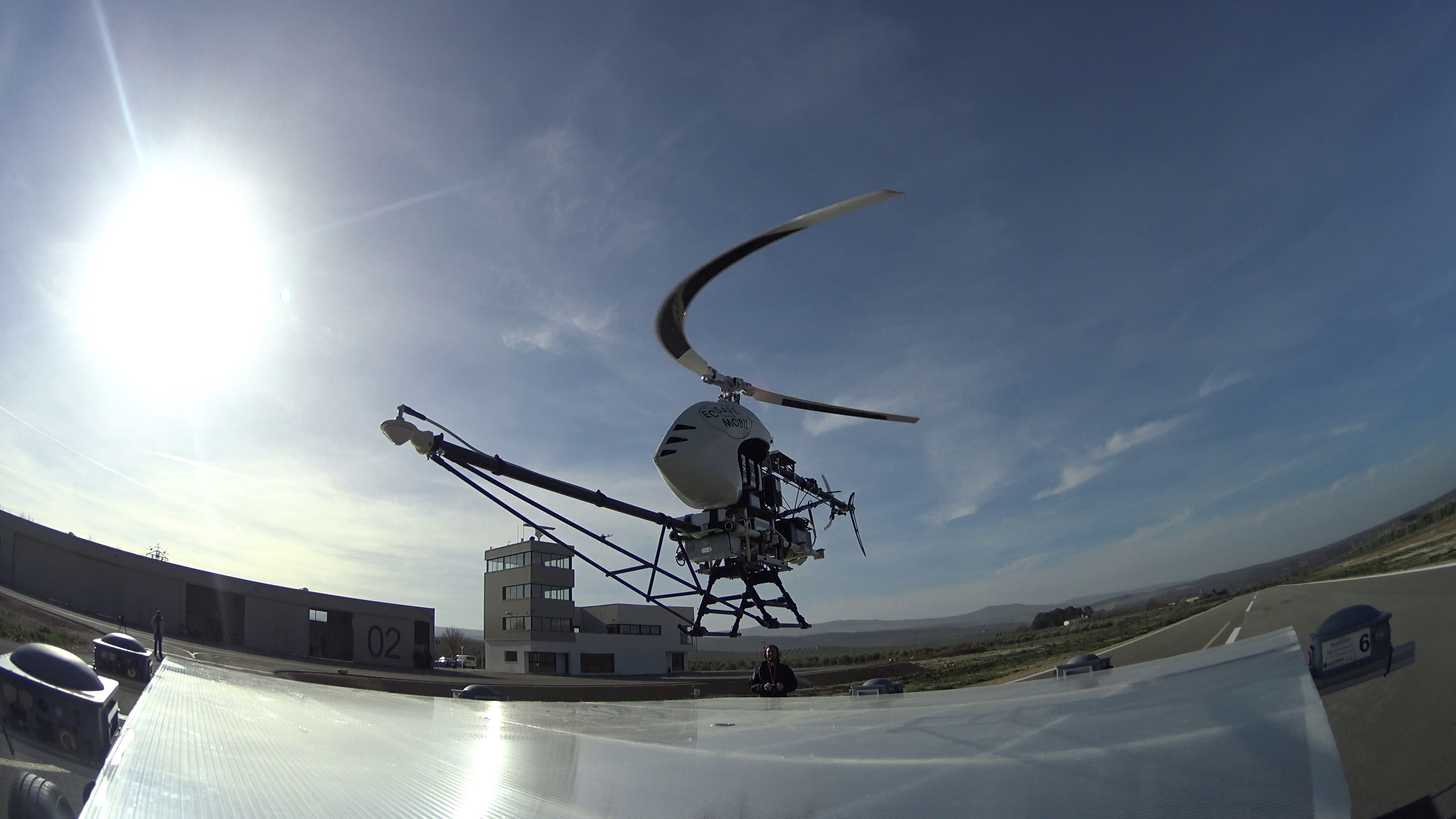
Scenario 1: The Radio Based System has been successfully integrated in an autonomous helicopter. Several experiments have been conducted in December 2015 in ATLAS facilities demonstrating the performance of the estimation and control methods developed in the EC-SAFEMOBIL project.
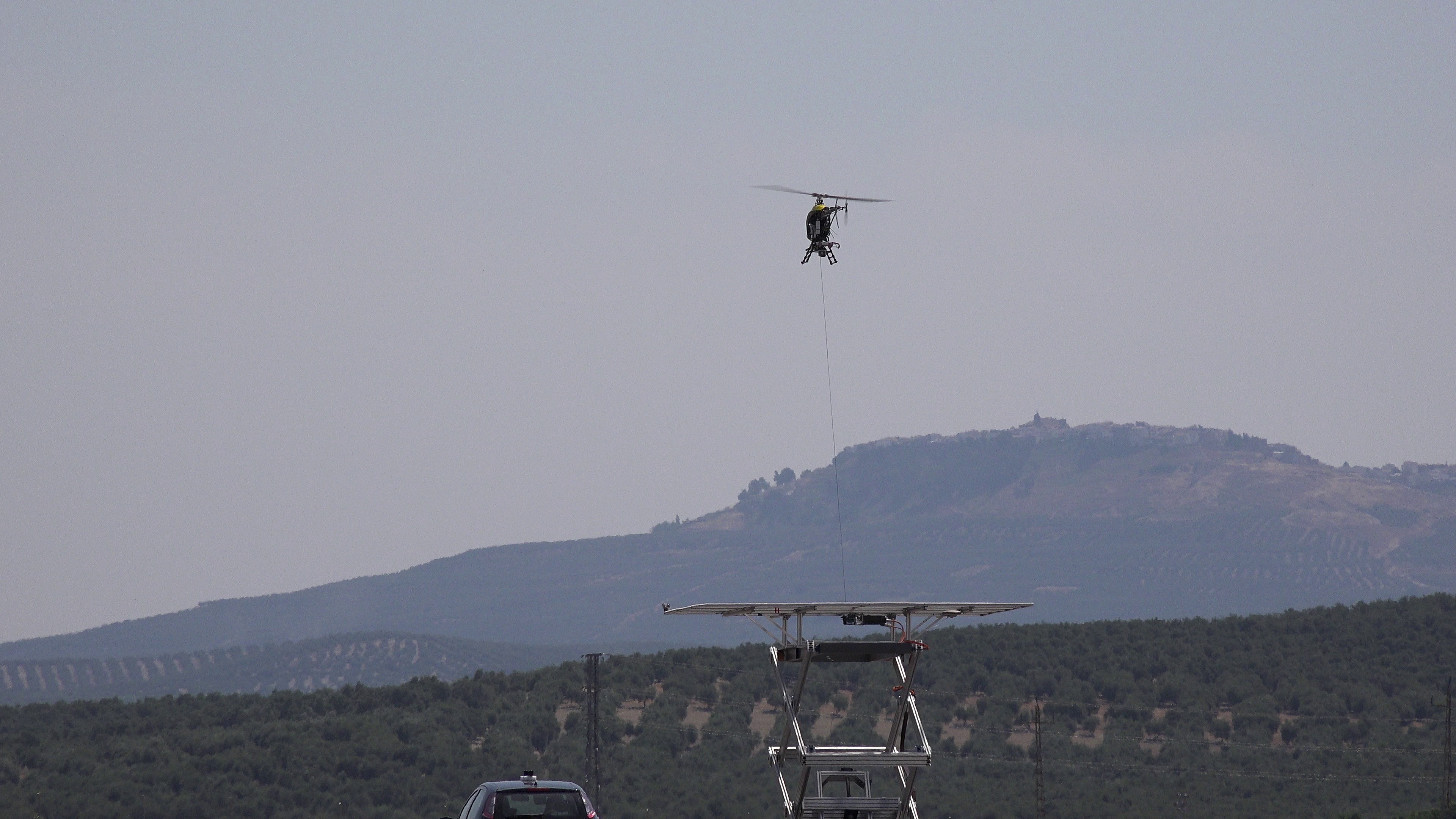
The tests for Scenario 2 were developed in ATLAS Experimental Flight Centre premises in Jaen (Spain) last spring and summer, and were carried out using an unmanned electric helicopter, a clamping support device to ensure complete landing and a platform with 3D movement, created specifically for the test. Satellite positioning systems (such as GPS) was not used.
Scenario 3 experiments have been successfully carried out in Munich in the last quarter of 2015, demonstrating the landing of the Penguin BE UAV on top of a modified car with a roof-mounted landing platform.
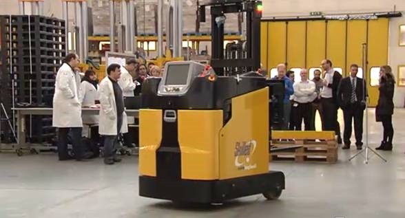
Scenario 4 was demonstrated at Euroimpianti facilities, where Unmanned Ground Vehicles were able to navigate autonomously in a warehouse environment, fulfilling the established requirements in accuracy and safety.
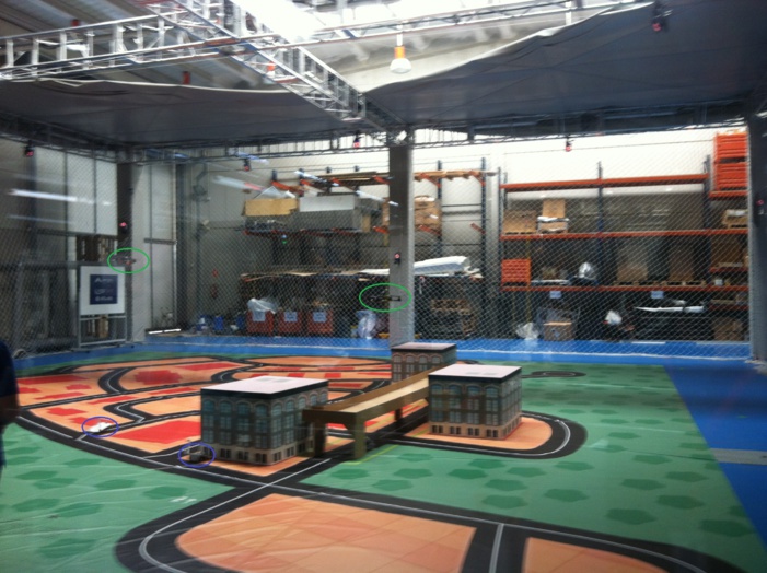
The experiments for Scenario 5 have been carried out at FADA-CATEC facilities, where a swarm of quadcopters were able to survey, identify and follow several intruders on a simulated city plot.
The EC-SAFEMOBIL project is partnered by nine institutions from five countries and a budget of 6.2 million euros, of which 4.5 million are funded through the Seventh Framework Programme of the European Commission.
30th December, 2015- The EC-SAFEMOBIL European project, an initiative under the 7th Framework Programme for R&D of the European Commission, is lead by the Centre for Advanced Aerospace Technologies (FADA-CATEC) in collaboration with the University of Seville, in the field of autonomous systems and unmanned aerial vehicles. This project, coordinated by Prof. Anibal Ollero, was launched in 14th July, 2011, will be finalised next January, 2016 and has successfully managed to conclude the experiments that demonstrate the advances produced by the international consortium. These tests will be ready for implementation in a short time, due to the relevance of industrial needs that have been guiding all developments.
This initiative pursues to develop new technologies of multivehicle cooperation using unmanned aerial systems, particularly new methods of accurate position estimation and motion control that will make UAS and ground autonomous systems more secure and reliable for a wide range of applications such as disaster management, search and rescue (especially under extreme conditions), security and other missions that involve a risk to humans. Particular short term applications include the landing of autonomous helicopters on boats, the landing of fixed wing aircrafts on top of ground vehicles eliminating the need of landing gears, the application of multiple ground automated guided vehicles for autonomous warehousing, and the surveillance and tracking of multiple ground targets by means of multiple unmanned aerial systems.
SCENARIO 1 Rotary-wing UAV Landing on a mobile platform
The performances of a Radio Based System (RBS) relative positioning system (http://deckfinder.net/) have been already analysed through its integration on an unmanned helicopter by comparing the telemetry data acquired in several teleoperated flights with the data provided by a GPS/RTK (Real Time Kinematic) system. Furthermore, simulations with a RBS emulator have been performed in order to validate the guidance, navigation and control strategy for rotary wing RPAS landings on moving platforms.
The RBS system has been integrated with the FADA-CATEC autopilot technology enabling the navigation of the unmanned helicopter in an autonomous way. In December 2015 landing tests have been performed on the premises of ATLAS Experimental Flight Tests Centre for unmanned aircrafts ascribed to FADA-CATEC and located in the town of Villacarrillo (Jaén, Spain). For this purpose, a specifically designed landing platform able to perform variations in height as well as horizontal and transversal translations have been developed. The experiments demonstrated the performance of the estimation and control methods developed in the project. Furthermore, the RBS system has been integrated and tested in an industrial helicopter for product development and marketing after the completion of the Project.
SCENARIO 2 Rotary-wing landing on a mobile platform using tether
Landing tests have been performed on the premises of ATLAS Experimental Flights Centre. These are the only facilities in Spain that have been designed specifically to test light unmanned aircraft.
The test was conducted using an unmanned electric helicopter and a clamping device based on a rope and a 3D moving platform, specifically created for the development of the test. The system does not make use of satellite positioning systems, such as GPS. The results of this trial are of great interest for the aerospace sector, as they could be applied for landing in situations where such operations cannot be carried out due to a moving landing platform and wind conditions, even during the absence of reliable satellite positioning signals. Furthermore, these developments are being implemented taking into account security conditions that may facilitate the integration of UAVs in non-segregated airspace, which already implies an advance for future use in scenarios in which people can also intervene.
During the test, which took place in June 2015, several experiments have been carried out to: perform an automatic landing of an autonomous helicopter on the mobile platform simulating bad weather conditions (high winds and major movements of the landing platform); successfully apply a fastening system to compensate for disturbances and relative movement between the aircraft and the platform; increase the security during operation and enhance its integration with the UAV flight control system.
SCENARIO 3 Landing of a fixed-wing UAV on top of a moving ground vehicle
The objective was to demonstrate the automatic and safe landing of a fixed-wing UAV on top of a mobile ground platform. This aim is motivated by the interest of improving the payload capacity of light UAV by eliminating the need of a landing gear with heavy structural parts which are being carried around needlessly for the most part of the flight. Such landing system would also allow for the compensation of atmospheric disturbances and facilitate a landing in adverse wind conditions (stronger gusts and crosswinds). This directly leads to an increase of the system’s operational availability.
In this scenario the new technologies for cooperative control of UAV and ground vehicle as well as the technologies for reliable estimation of the relative motion have been developed. In addition to the technological development along these two general lines, many practical related problems, like treatment of the airflow close to the car surface in the UAV control, dealing with communication delays and forecast of the relative positions and velocities as well as the safe switching between different operation modes of the overall systems has been studied and corresponding solutions were developed.
The theoretical work was performed in parallel with extensive simulations and field experiments. For experimental work a setup composed of a ground vehicle and UAV were developed. The experiments in this scenario have been conducted on the airfield of Grob Aircraft Corp., the first German UAV testing facility, near Munich, starting with the landing of a manually piloted small fixed wing UAV on a platform mounted on top of a moving ground vehicle. The induced ground effect through close proximity flight and landing with the small UAV was studied and the effect considered in the final control strategy. Later the experiments were conducted with the Penguin BE UAV with 20 kg take off weight. Special control modes for UAV as well as methods for vision based relative position estimation were developed and optimized in extensive flight experiments.
Finally, the Penguin BE UAV with 3.3 m wing span and 2.3 m overall length was able to land on a platform with 4 m length and 5 m width by the ground speed between 70 and 80 km/h. According to the results from flight experiments, the developed methods allow to move the ground vehicle and UAV in coordinated way with a precision of less than 0.8 m. The experiments demonstrated also the reliable and repeatable system performance as well as the safe operation with automatic recognition of critical events and elaborated procedures for their handling. The final experiments were conducted in December 2015.
SCENARIO 4 Autonomous distributed warehousing
Scenario 4 is devoted to Automated Warehousing Systems (AWS), and demonstrations of a high accuracy markerless localisation and decentralized coordination of automated guided vehicles (AGV) in particular, proved the potential of newly developed methods for industrial exploitation.
Markerless localisation with the pose estimation error lower than 1 cm and 0.5 deg was accomplished by using a laser range sensor mounted on the top of the AGV and by using the feedback of the AGVs’ odometry system. A previously acquired map of the warehouse environment is used to match the on-line data acquired from the laser range sensor. Better accuracy of pose estimation was achieved combining the adaptive Monte Carlo localisation method, the iterative closest point algorithm and the discrete Fourier transform. The tests of the new localisation method were carried out first in the laboratory test bed with a group of Pioneer 3DX mobile robots and then in the industrial facility with real AGVs from the project partner Euroimpianti. Demonstration of a repeatability test proved the value of a new localisation method for industry applications.
Another goal of demonstrations was to verify the scalability of a new decentralized control algorithm for tens and hundreds of AGVs deployed in one installation. By running the algorithm on each vehicle in the system, vehicles are able to autonomously plan and execute their motions, detect collisions with other vehicles in communication range and reliably resolve different conflict scenarios with other vehicles in the environment. Decision making in conflict situations is conducted in a way that it ensures no collisions with other vehicles nor any system deadlock situation will occur. Simulation experiments and experiments carried out in the laboratory test bed indicated that the algorithm features satisfy the scalability requirements – from five vehicles in laboratory experiments to twenty vehicles in simulations. Experiments with AGVs in the realistic environment of the Euroimpianti facility proved the ability of AGVs to resolve four different situations, constructed to demonstrate the capabilities of the developed decentralized control system: vehicle waiting for its path to be cleared, vehicles resolving head-on conflict in a confined space, removal of the idle vehicle from the path of another vehicle, and resolving the vehicle failure.
SCENARIO 5 Tracking and Surveillance
Scenario 5 is devoted to surveillance and tracking within a complex urban environment utilising unmanned aerial systems (UAS).
Demonstrations performed in a hardware-in-the-loop environment have shown cooperative fault detection and recovery for two use cases applicable to systems with 2 levels of assurance requirements. These contribute to the objectives of maximising autonomous operations and of providing a fault-tolerant system with graceful degradation.
Demonstrations in the software-in-the loop environment have shown cooperative target detection and tracking in a large scale, complex environment where the distributed nature of the system is essential, as well as showing the scalability of the system, with increasing numbers of participants incorporated without significant increase in processing load. The validity of the algorithms beyond the lower fidelity system models within the simulated environment has been proven through the scaled down real world experiments in the hardware in the loop environment. This set of demonstrations have contributed to the objectives of maximising autonomous operation, providing multi-entity cooperative target tracking systems, and incorporating dynamic system scalability.
The nature of the development work is such that its impact on the capability of surveillance and tracking systems is less apparent when considering the demonstrations in isolation, but becomes highly apparent when consideration is given to the operational load of such a system without the developed capability. It is clear that the development work can provide a significant contribution to the removal of barriers to multi-platform utilisation in complex scenarios.
Control of multiple mobile units, whether unmanned aircrafts or unmanned forklifts, has a lot of common characteristics that enable the use of the same methods of decentralized control, such as the S-Adaptive Pseudospectral collocation method, which was successfully applied and experimentally confirmed in both AWS and UAS application areas.
Videos of the demonstrations are available via the EC-SAFEMOBIL website: http://www.ec-safemobil-project.eu/
EC-SAFEMOBIL project
The EC-SAFEMOBIL project is paving the way for the implementation of unmanned systems in new settings. Besides landing a UAV on moving surfaces, the project is developing other new technological demonstrators, such as the tracking of several ground vehicles using multiple unmanned aerial systems with capacity to avoid collisions. Also, the position estimation technology and motion control that is being developed in EC-SAFEMOBIL has demonstrated other applications such as warehouse automation through the cooperative work of multiple autonomous ground vehicles.
The EC-SAFEMOBIL project is partnered by nine institutions from five countries and involves both industrial companies that are international leaders in their sectors and research organizations that have proven research excellence in many projects. Besides FADA-CATEC and the University of Seville, the consortium is formed by Indra (Spain), SELEX Galileo (UK), DLR (Germany), Airbus DS (Germany), EUROIMPIANTI (Italy), the University of Duisburg-Essen (Germany) and the University of Zagreb (Croatia). EC-SAFEMOBIL has a budget of 6.2 million euros, which the European Commission contributes EUR 4.5 million.
EC-SAFEMOBIL project website: http://www.ec-safemobil-project.eu/
Further information:
Celia Ruiz (Press FADA-CATEC) +34 954 62 27 27
cruiz@euromediagrupo.es
Download press release and photos:

